Figure 1-6. The situation at the Berezina River on November 26 (1-6a), November 27 (1-6b), and November 28 (1-6c). Small multiples with large maps like these have to be studied in order to understand the narrative they convey, especially when compared with the multiples in figure 5-28.
It is also possible to use a single map to depict the dynamics of an event. Figure 1-7 shows the path that Gerrit Janz Kraak took through Russia, supplemented with arrows and labels with dates that help to give the reader a sense of movement in time. Figure 1-8 shows a family tree indicating the relationship between Gerrit Janz Kraak and the author. In figure 1-9, the author uses a space-time cube to compare Napoleon’s crossing of the Berezina River with his own path though the region during his visit to the river two hundred years later. This cube plots time along the vertical axis and space along the horizontal plane, placing the 1812 map below and the 2012 map above. Annotations, pictures, and labels give substance to specific events and locations. Between the two horizontal maps, vertical orange lines connect the same locations in both times. Figure 1-11 presents scenes from two alternative dynamic representations of the event, namely, war games maps. Users of this media can experience an event by replaying it. The top game shows action, while the bottom game displays the hexagonal grid that typically belongs to these kinds of maps.
Figure 1-7. The map shows the path of the IX Corps during the Russian campaign. It did not enter Russia until September of 1812, when it advanced to support Napoleon’s retreat from Moskva. Gerrit Janz Kraak died in the Battle of Berezina on November 17, 1812. Below the map is an entry from the military records of the French army.
ABOUT GERRIT JANZ KRAAK
Gerrit Janz Kraak was born on February 27, 1790, in the city of Sneek in the north of the Netherlands. He was the son of Jan Gerritsz Kraak, a soldier in the garrison of Sneek, and Rintske Watzes Vollenhoof (Craeck 2002). After Napoleon incorporated the Netherlands into the French Empire, the Dutch had to serve in the army. A member of a company volunteers in the province of Friesland, Gerrit Kraak was conscripted in September 1809 and moved to Utrecht. In July 1810 he signed a contract (no. 2298) for five years and joined the 125th Line Infantry Regiment, a Dutch unit in the French army (Roulin 1890). He died in the Battle of Berezina on November 27, 1812.
Figure 1-8. Gerrit Janz Kraak, one of Napoleon’s soldiers who died in the Battle of Berezina, is an ancestor of the author, pictured here at the battle site’s monument commemorating French losses. Gerrit Janz Kraak had many brothers and sisters, most of whom died very young.
Figure 1-9. Comparing Berezina across two hundred years using a space-time cube. Below, the path that the French and Russians took during the crossing of the Berezina River in 1812, and, above, the path that the author took to visit the battlefield. The paths have been annotated with labels, pictures (1812), and photographs (2012). Vertical orange lines represent four prominent places.
Further reading
Napoleon’s 1812 campaign has been extensively studied, and many books and papers analyze myriad aspects of this ill-fated adventure in great detail. The works by George Nafziger (1988) and Paul Britten Austin (2000) are good places to start. In 1812: The Great Retreat, Austin describes Napoleon’s disaster using eyewitness reports found in archives and personal diaries. For Russian perspectives (written in English), both Laurence Spring (2009) and Dominic Lieven (2011) describe the campaign and Alexander Mikaberidze (2012) provides Russian eyewitness accounts. Faber du Faur (2001) offers an illustrated eyewitness report from the vantage of a lieutenant in Napoleon’s army in With Napoleon in Russia. Diaries of Eugène Labaume (2002) and Philippe-Paul de Ségur (1836, repr. 2005) provide vivid testimonies to the glory and horror of the march. Of course, Carl von Clausewitz’s report, The Campaign of 1812 in Russia (1843, repr. 2007) and Leo Tolstoy’s War and Peace (1869, repr. 2001) deserve mention as well.
Figure 1-10. Dutch infantry at the bridges over the Berezina in 1812. The troops try to hold off the Russian advance while others cross the bridges. Detail from a painting by Hoynck van Papendrecht in a series of posters specially prepared for Dutch history education at the beginning of the twentieth century.
Figure 1-11. War game maps: Top, Napoleon at Berezina. Bottom, Map of the Berezina 20 / Closing the Trap in Russia, 1812 Game.
2
Minard’s map
This chapter discusses Minard’s map in detail, places it in the context of his other works and his times, and compares it with other maps that analyze Napoleon’s campaign. Edward Tufte, the noted statistician, regards Minard’s map as probably the best statistical graphic ever drawn. What makes this celebrated map so special? The answer requires a closer look. Figures 2-1 and 2-2 display two versions of the map, the original and an adaptation translated into English and redrawn to explain content.
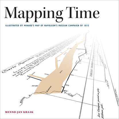
Figure 2-1 The “Carte Figurative des pertes successives en hommes de l’Armée Française dans la campagne de Russie 1812–1813,” translated as: “The Figurative Map of the successive losses of men of the French army during the Russian Campaign 1812–1813.”
2.1 The map
Cartographers classify Minard’s work as a flow line map, or flow map for short. These maps overlay lines, typically punctuated by arrowheads, to indicate both the direction and route of movement across a given territory. Origin-destination maps vary slightly from this norm, because they emphasize the connection between locations, rather than the flow from one location to another.
In contrast to flow maps, origin-destination maps’ paths are highly structured, and do not use arrowheads to indicate direction. Both types of maps illustrate the volume of flow by varying the thickness of the path line’s shaft, some by gradually trimming the thickness of the shaft, others by splitting the shaft into sections and giving each section its own uniform thickness. Minard’s map, for example, splits his line into sections to indicate the ever-diminishing size of Napoleon’s army. With just a glance, flow line maps give readers an immediate impression of both the direction of something in motion and also the volume of its flow, as Minard did in his studies of transportation, commerce and, in this case, war. True to form, Minard split his line into sections to indicate volume. However, it appears that he did not use arrowheads. At first glance, someone who was not familiar with the topic might not be able to interpret the direction of the movement. However, the text below the map’s title explains that color indicates direction: “The red (which appears orange in figure 2-2) designates the men who enter into Russia, the black those who leave it.”
Ideally, good maps should immediately be clear to the reader. To understand their content, however, French cartographer Jacques Bertin argues that readers must adopt a traditional three-step map-reading approach (Bertin 1983 [1967]). First, readers should execute an external identification of the map, asking what the map is about. Reading the title of the map can often answer this question. Minard’s title is rather long: “Figurative Map of the successive losses of men of the French army during the Russian campaign 1812–1813.”
The second step calls for internal identification, how the topic is displayed. This requires reading the legend to find out how symbols represent the elements of the topic and what scale is used. It also calls for a study of the map’s