Figure 2-9 shows yet another one of Minard’s flow line maps, displaying the transport of animals into Paris. The symbol representing Paris is large enough to allow all flow line segments to enter the city without creating any visual clutter. Place-name labels approximately indicate location. The different colors of the flow lines refer to the different types of animals transported. For example, blue segments represent sheep. The numbers inscribed along the segments denote the total weight of the transported animals. As the title indicates, this is a “Carte figurative at approximative.” Minard wished to emphasize a theme with his maps, whose geography he only employs as support. This is also the case in the map shown in figure 2-10, where country borders and coastline adapt to flow lines, to give readers an impression of the business of railroad traffic in this region of Europe.
Figure 2-9 (opposite). Detail of an 1864 flow map representing animal transport into Paris; inset displays title and legend. (“Carte figurative et approximative des poids des bestiaux venus á Paris sur les chemins de fer en 1862.”)
In figure 2-11, one of Minard’s more complex flow line maps shows the transport of fossil fuels along French railroads and waterways. Here, he distinguishes between the two modes of transport by shape, using straight segments to represent railroads and curved ones to represent waterways. (See, for example, the lower left inset, where the curved segment represents the River Rhone.) Color distinguishes between the origins of fuels, as the legend in the middle-right inset explains. For example, blue represents Belgium and green Britain. In the inset on the upper right, Minard had to use all his skills to avoid visual clutter when he drew this enlargement of the crowded areas that surrounded Dijon.
Figure 2-10 (above). Detail of a flow map drawn in 1865 that represents the number of train passengers in Europe in 1862. (“Carte figurative et approximative du mouvement des voyageurs sur les principaux chemins de fer de l’Europe en 1862.”)
Figure 2-11 (opposite). Map, drawn in 1861, represents the amount of fossil fuels transported in France via railroad and waterways in 1859. (“Carte figurative et approximative du mouvement des combustibles minéraux sur les voies d’eau et de fer de l’Empire français pendant l’année 1859.”)
Figures 2-12 and 2-13 both display time series, which make them fitting topics in this book. Figure 2-12 compares the volume of merchandise transported through France during the years 1845 and 1859. Side by side, the two maps establish a clear increase in volume. Once again, geographical features of France remain crude and functional. Interestingly, manipulating local topography in order to “fit” a theme, such as Minard did, has grown more difficult these days, because “exact” data sources make it more difficult to apply artistic license. However, a few schematization solutions do exist such as generalization algorithms that can be applied locally.
The time series in figure 2-13 tells an interesting story. The maps show the origin of raw cotton imported by Europe in the years 1858, 1864, and 1865. In 1858, England imported most of its cotton from the United States, as indicated by the blue flow lines. In 1864 US imports almost completely disappeared due to the Civil War, and were replaced by imports from India and Egypt. The flow of US imports recovered in 1865, but only slightly, while the other competing cotton sources sustained the level of their shipments to England.
In his maps, Minard created a supporting topography that has its own story to tell. Here it plays this role fully. As Robinson (1967, pp. 95−96) observed: “Accordingly, he revised coastlines, paid little attention to projections, and forced the scales of the geographical features on his maps to fit the data being portrayed rather than vice versa, as is usually done today.” Note how in figure 2-13, Minard adapted the width of the Strait of Gibraltar to allow the large volume of cotton from Egypt to pass. He widened the English Channel and sacrificed Ireland to make room for the cotton entering Britain. Across the Atlantic, he even generalized the North American coastline to make it fit the edge of the map.
Figure 2-12. Comparing the tonnage of goods transported in 1845 and 1857. Flow map drawn in 1859. (“Carte figurative et approximative des tonnages de marchandises qui ont circulé en France en transit en 1845 et 1857.”)
Figure 2-14 shows another cartographic innovation of Minard, a map with pie charts. Playfair invented them, but Minard first introduced them on maps (Friendly 2002). Figure 2-14 shows the relationship between import and export data for French harbors. The size of the pies represents the total transfer of goods in each harbor. Clearly, Minard consider topography important this time because he has delineated the coastline in great detail. Also, note Minard’s approach to the pie-chart sectors. In today’s maps, a pie chart would “start” in the 12 o’clock position; in contrast, Minard balanced sectors equally before and after 12 o’clock.
Figure 2-13 (below). The import of raw cotton in Europe, comparing the years 1858, 1864, and 1865. Flow map drawn in 1866. (“Carte figurative et approximative des quantités de coton brut importées en europe en 1858, en 1864 et en 1865. 1866.”)
Figure 2-14 (right). Relative size of French harbors based on import and export data from 1857; black is export and blue import. The numbers refer to a list of harbor names on the map. For example, “1” refers to Brest and “38” to St. Malo. Diagram map drawn in 1859. (“Carte figurative et approximative de l’importance des ports maritimes français mesurée par les tonnages effectifs des navires entrés et sortis en 1857.”)
The map detail in figure 2-15 presents another one of Minard’s innovations, not necessarily from a design perspective, but certainly from an analytical one. The proportional point symbol map of Paris uses squares to indicate the number of inhabitants living in each district in the city’s arrondissements. Analyzing the spatial distribution of the population these squares help to illustrate, Minard could suggest the best location for a new city post office. The map, far ahead of its time, functions as a kind of spatial analysis. Although less well known than John Snow’s map of the London cholera epidemic, from a spatial-analytical perspective, Minard’s map similarly suggests GIS avant le lettre.
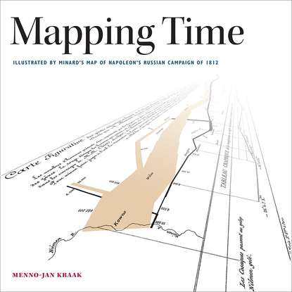
2.3 Mapping 1812
This section discusses a selection of maps that share Napoleon’s campaign to Russia as their main topic. These are split in three categories: maps created to study the event, maps that have been inspired by or give challenge to Minard’s design, and maps that can be considered as curiosities.
Figure 2-15. Detail of a proportional point symbol map from 1865 showing the population in each district of Paris, with the objective to find a suitable location for a post office. Overview as inset. (“Carte figurative relative au choix de l’emplacement d’un nouvel hôtel des postes de Paris.”)
As a historical event
The Napoleonic Wars rank as one of the important episodes in European history, and few events during the conflict were more important than the invasion of Russia. Many of the maps that study this phase of history depict this event, from small annotations in generic history atlases to detailed overviews in dedicated atlases. One of the first maps to illustrate the Russian campaign appeared in an atlas published before Minard’s map entitled