Dams across the groughs regenerating peat (Walk 32)
The Dark Peak is a major source of enjoyment and recreation for people who use the area. From walkers to climbers, mountain bikers, photographers, runners, bird watchers and people who just sit and enjoy this landscape, it has plenty to offer everyone.
Local services and transport
The Dark Peak sits predominantly within the Peak District National Park. This was Britain’s first national park, established on 17 April 1951. There are National Park Visitor Centres at Castleton, Edale and the Upper Derwent Valley, as well as ranger offices throughout the area. Details of all these and useful contacts can be found at www.peakdistrict.gov.uk.
Transport to and from the walks is more frequently by car and bike these days, but public transport is still available either by bus or train. The main Sheffield to Manchester rail line runs through the centre of the Dark Peak and is a useful means of accessing the area, with stations at Grindleford, Hathersage, Bamford, Hope, Edale and New Mills. Glossop and Marsden also have stations for access to the more remote areas. Transport by bus is obtainable from Sheffield, Manchester, Derby and Buxton. For details visit www.peakdistrict.gov.uk/visiting/publictransport.
The north of the Peak District has fewer and less frequent transport connections, so please take time to ensure that transport is available, especially at the end of a walk.
The central section of the Dark Peak contains the major centres of commerce and residence. Hathersage, Castleton, Glossop and Marsden all have shops, bars, restaurants and accommodation, making them good bases for the walks. Once away from these areas there is little available, which is part of the attraction of the Dark Peak. Therefore it is wise to take plenty of food and drink along on the walks. Details of accommodation and events can be found at www.visitpeakdistrict.com.
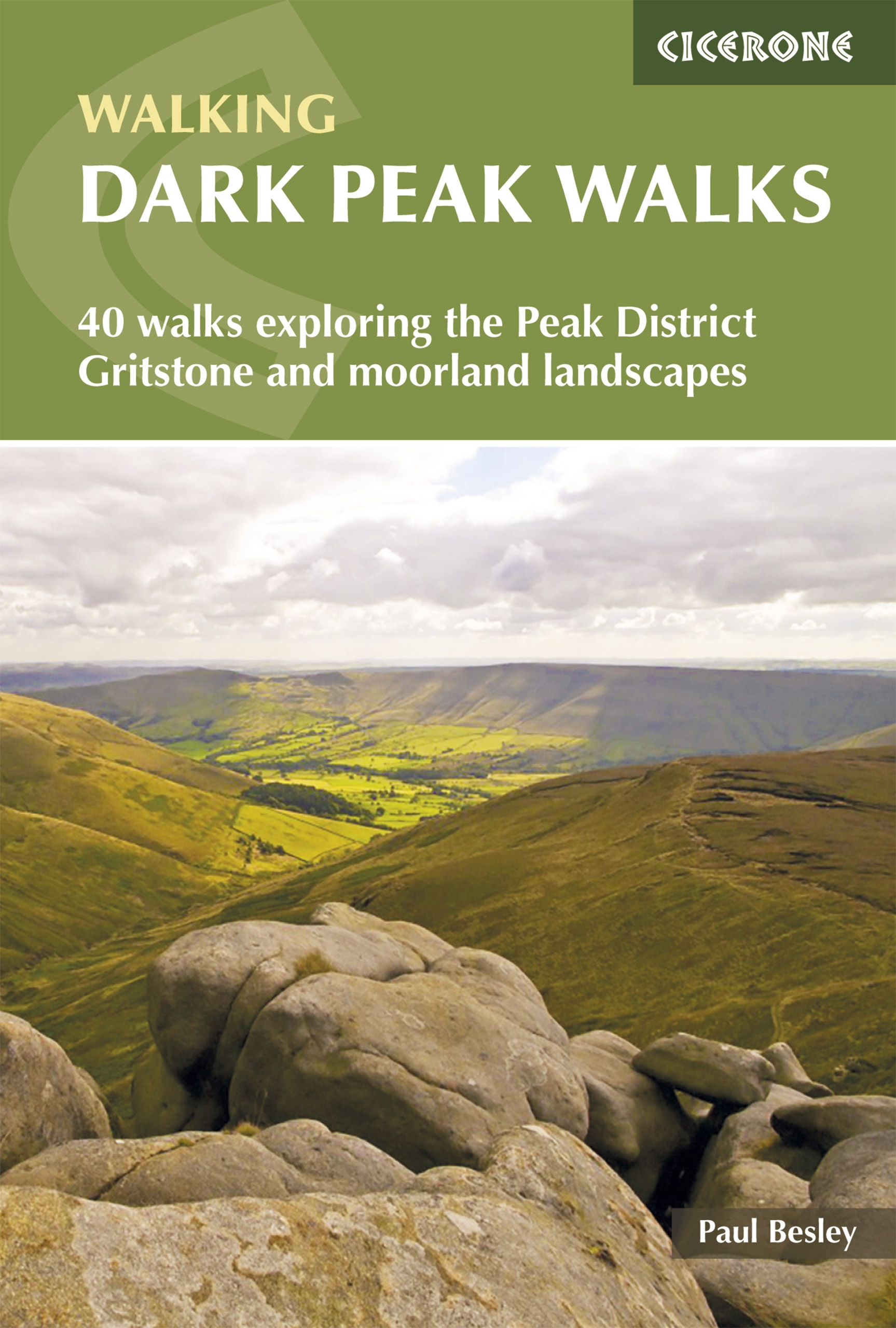
The walks
The walks cover the whole of the Dark Peak. Some will be new to readers, others may be old friends. The book splits the Dark Peak into areas, each having a range of walks from short to long, some with more ascent than others. The shorter walks can be used as an introduction to each area, giving a brief taste of what is on offer. The medium-length walks offer a good day of walking that is not too taxing, while the longer walks are for those who want to lose the thronging crowds in the valley below and experience a true moorland wilderness experience.
Walking up Grindsbrook (Walk 24)
There are some steep climbs in the Dark Peak and some of these are included in the walks to get the blood pumping. Some ascents tend to be gentler giving the walker time to look around, which is a joy because this is a landscape of high wide vistas and big skies, especially on the high moorlands.
Responsible walking
Many of the walks are over grouse moors. These are highly managed environments specifically designed for the production of grouse for sport shooting. As such the landowners have the right to close a moor for public safety and the protection of the grouse and other ground-nesting birds. The landowner may also exclude dogs entirely from the moor or with certain exceptions. It is useful to check whether the moor has been closed or if there are any restrictions. This information can be found on the Natural England CRoW website at www.openaccess.naturalengland.org.uk.
Walking in the Dark Peak also brings a responsibility to ensure that no damage comes to the moor or the plant and wildlife by our actions. A moorland fire in May 2016, resulting from a portable barbeque being carelessly left behind, caused extensive damage to the heath and the destruction of much wildlife. Please act responsibly when on the moor: do not have open fires or barbeques, do not discard cigarettes or leave litter. Please follow the countryside code and remember to leave only footprints and take only photos and memories.
Maps and navigation
All walks have been plotted using Ordnance Survey online mapping tools. The main paper maps for the area are the OS Explorer Dark Peak OL1 and White Peak OL24. Harvey and the BMC Dark Peak maps are also useful. Always take a map and compass, even if you are using a GPS device.
A word of caution: do not underestimate the area. Walking on the high moors – Bleaklow, Kinder Scout, Derwent and Howden – requires excellent navigation skills, especially in winter. It also requires good equipment and a knowledge of how to use it, and clothing that is appropriate to the time of year. The use of walking poles when crossing moorland can be helpful for maintaining balance and forward motion. They can also be useful when descending some of the steeper sections of the walks.
Smartphones can prove invaluable, especially when combined with a mapping app. However, these do drain the batteries, so be careful. One advantage of having a smartphone should you get into difficulty and need assistance from Mountain Rescue is its ability to let the teams know where you are, making rescue a much easier and quicker process. It is therefore advantageous to carry one of these devices for emergency purposes.
Big skies in the Dark Peak (Walk 7)
Using this guide
The book is split into areas running from the east over to the west. The walks were researched that way and it seemed a logical way of progressing. The first walk, from Chatsworth, is a gentle introduction to Dark Peak walking. The last, along the Roaches, ends the tour of the Dark Peak in the most magical way, looking out over England and on into Wales, a huge flat plain spread out before you. Perhaps you will pick an area and explore it. The walks have been kept as far away from each other as possible to allow for a fresh experience on each walk, and the routes stay as far from roads as possible also. This could have limited some walks, however, so some road walking is necessary on certain routes. Some walks can be cut short, such as the one from Grindleford to Higger Tor (Walk 5). There is so much to see and explore on all of the walks; there is nothing wrong in just walking to a particular feature and returning along the same path.
There is no perfect time to do the walks. The beauty of the Dark Peak is that it will serve you up a different experience every single time. It is recommended that you do the walks again and again and at different times of year for the full effect.
A rainbow on Barrow Stones (Walk 11)
This guide includes an overview map and a route summary table. Use these in conjunction with the walk introduction at the beginning of each walk to select a suitable walk or series of walks. Timings are my walk times and do not include stopping for photographs, tea, ice creams or any other such comestible, getting lost or taking wrong turns. I have been generous with time, as there is no reason to rush across this magnificent landscape.