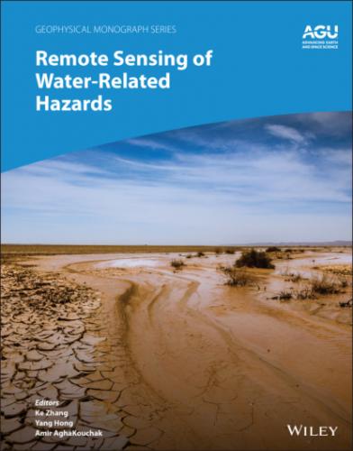
Remote sensing of hazards will be increasingly looked upon to reduce our vulnerability and increase our resilience against extreme events. However, understanding the breadth of the available contributions in this area is challenging because scientists from different fields have used satellite observations to address problems in their own disciplines. For this reason, publications on remote sensing of hazards have appeared in disciplinary journals of many fields (such as hydrology, ecology, climatology, geography, agriculture, sensor deign, and social sciences). This can limit the visibility of disciplinary studies within the broader water hazards community.
This monograph bridges the disciplines to provide an overview of the available data, sensors, models, and indicators developed for the monitoring and prediction of various kinds of water hazards. The book reviews recent advances in remote sensing of floods, droughts, rainfall‐triggered landslides, and their associated secondary hazards. The main objective is to offer an up‐to‐date look into water hazards from contributions of scientists with different backgrounds.
This book is organized into 13 chapters, each representing an independent but still interconnected topic related to water hazards. The first chapter describes the background, scope, objective, and organization of this book. Part I considers precipitation and storms, with chapter 2 reviewing recent progress in satellite remote sensing of precipitation and chapter 3 devoted to the application of ground‐based mobile Doppler radar for monitoring tornadoes and storms contributing to water hazards such as flash floods and floods. Part II focuses on flood‐related topics. Chapter 4 reviews methods for using satellite remote sensing for flooding mapping and risk assessment, while chapter 5 explores the utility of quantitative satellite precipitation estimations for early warning and frequency analysis. Chapter 6 describes a new multisource data‐driven web GIS‐based modeling framework for flood forecasting and prevention, while chapter 7 introduces a new ensemble‐based remote‐sensing driven flash flood‐landslide early warning system. Finally, chapter 8 introduces new methods for detecting hazard‐damaged bridges using multitemporal high‐resolution SAR imagery. Part III is dedicated to drought‐related topics starting with chapter 9, which gives an overview of drought monitoring using remote sensing. Next, chapter 10 examines vegetation responses to drought disturbances, while chapter 11 considers how the Gravity Recovery and Climate Experiment (GRACE) satellites can be used to assess water scarcity. Finally, the use of satellite remote sensing and numerical models is discussed for understanding water cycle variation in chapter 12, and for using ground and satellite sensors for assessing soil salinization in agricultural areas in chapter 13.
Although there are monographs focused on one single water‐related hazard such as flood or drought, we believe there is merit in an overview with a focus on multiple water hazards (here, floods, droughts, rainfall‐triggered landslides, and their associated secondary hazards). We hope that this collection of topics from different areas attracts scientists who work at the interface of multiple water hazards.
Finally, completing this book would not have been possible without the support and assistance of many individuals, including the authors who shared their expertise in this book. We offer special thanks to the reviewers and Jenny Lunn, Director of Publications at AGU, for their constructive and thoughtful comments, which led to substantial improvements in the quality of the book. This book was partially supported by the National Key Research and Development Program of China (2018YFC1508101), the National Natural Science Foundation of China (51879067), the Natural Science Foundation of Jiangsu Province (BK20180022), the Six Talent Peaks Project in Jiangsu Province (NY‐004), the NOAA/Office of Oceanic and Atmospheric Research under NOAA–University of Oklahoma Cooperative Agreement (NA14OAR483), and the NASA Surface and Interior program (NNH10ZDA001NESI). We also thank AGU and Wiley for supporting the preparation and production of this book.
Ke Zhang Hohai University, China
Yang Hong University of Oklahoma, USA
Amir AghaKouchak University of California, Irvine, USA
1 Interdisciplinary Perspectives on Remote Sensing for Monitoring and Predicting Water‐Related Hazards
Ke Zhang1, Yang Hong2,3, and Amir AghaKouchak4
1 State Key Laboratory of Hydrology‐Water Resources and Hydraulic Engineering, and Yangtze Institute for Conservation and Development, and College of Hydrology and Water Resources, and CMA‐HHU Joint Laboratory for HydroMeteorological Studies, Hohai University, Nanjing, China
2 School of Civil Engineering and Environmental Sciences, University of Oklahoma, Norman, Oklahoma, USA
3 Advanced Radar Research Center, and Center for Spatial Analysis, National Weather Center, Norman, Oklahoma, USA
4 Department of Civil and Environmental Engineering, University of California, Irvine, California, USA
ABSTRACT
Water‐related hazards, including floods, droughts, rainfall‐triggered landslides, water‐scarcity‐induced soil salinization, and other interconnected hazards related to water, have caused considerable loss of human life and damage to property and infrastructure throughout human history. As significant progress has been achieved in satellite technology in recent decades, remote sensing of water‐related hazards has emerged as an effective tool for better monitoring of hazards and reducing our vulnerability to extreme events. This chapter presents an overview of this book, which reviews recent advances and presents new studies in remote sensing of floods, droughts, rainfall‐triggered landslides, and their associated cascading hazards. The main objective is to offer an up‐to‐date perspective on remote sensing of water‐related hazards across disciplines by presenting the work of scientists from different backgrounds.
1.1. BACKGROUND
Water‐related hazards broadly include floods, droughts, rainfall‐triggered landslides, water‐scarcity‐induced soil salinization, and many other interconnected hazards related to water. Floods and droughts, as the core types of water‐related hazards, have caused numerous losses of human lives and properties throughout human history (Du et al., 2018; Paprotny et al., 2018). With rapid socioeconomic development, population and industrial growth, and other anthropogenic activities over recent decades, many new water‐related challenges have emerged and imposed increasing threats on the built and natural environment (Lehnert et al., 2017; Wear et al., 2021; Zhang et al., 2021). Moreover, climate change and variability have altered regional to global
